 
| |||||||||||||||
|
FRIDAY HARBOR
"EQUILIBRE"
(balance)
 |
Brad Gislason 360-378-4860
Friday Harbor, WA ChartsWe supply the necessary charts for the San Juan Islands and Canadian Gulf Islands. Also as a courtesy some cruising guilds such as the WAGGONER and others are available. These Guilds are very handy in the summer to make reservations at some of the more popular marinas. They are a good source book for destination planning. Tide and current tables are in the navigator's toolbox as well. Our approach to navigation believes skill is needed, thus paper charts only.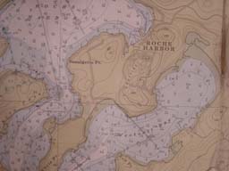 With a chart, current table, clock, dividers, parallel rules, compass, and knot meter/log a person should be able to go as they please. However it's not deemed weak to wait out the fog or storm below in a cozy harbor. Plus we use a GPS for added safety and a check on DR.
Equilibre lives here, in the center of the islands.
With a chart, current table, clock, dividers, parallel rules, compass, and knot meter/log a person should be able to go as they please. However it's not deemed weak to wait out the fog or storm below in a cozy harbor. Plus we use a GPS for added safety and a check on DR.
Equilibre lives here, in the center of the islands.
WeatherThe Pacific Northwest is known for a mild coastal climate, a lot of rain, and the cruising season is the summer only. What is not common knowledge, is the San Juan's are located in the Olympic mountain rain shadow, and thus get about half the rain Seattle gets. Seasoned sailors in these parts also plan trips for spring and fall as the weather is still quite warm, better winds, no crowds, cheaper moorage, more relaxed.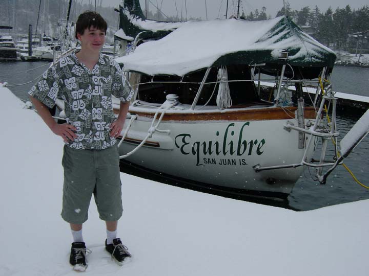 In winter we will get the rare white sunshine.
68k
Contact: Brad Gislason
at ISLAND CHARTERS 861 #2 Schoolhouse Rd. Friday Harbor, WA 98250 Phone 360-378-4860 · FAX 360-378-5982 Email bradgis@rockisland.com This page has been visited [an error occurred while processing this directive] times!
All material and graphics on this site try to be correct, but not guaranteed. All material and graphics on this site are ©2001 by Island Charter and Island Imaging
All Rights, Centers, and Lefts Reserved. |
||||||||||||||